Parkirišče Erichhütte - Hoher Kopf (Weg 432)
Ausgangspunkt: Parkirišče Erichhütte (1339 m)
| Breite/Länge: | 47,39164°N 13,04879°E |
| |
Wegname: Weg 432
Gehzeit: 4 h 45 min
Schwierigkeit: sehr schwierig markiert Weg
Höhenunterschied: 1536 m
Höhenunterschied entlang der Route: 1600 m
Karte:
Empfohlene Ausrüstung (Sommer): Helm, Klettersteigset
Empfohlene Ausrüstung (Winter): Helm, Klettersteigset, Eispickel, Steigeisen
Aufrufe: 3.155
 | 2 Personen gefällt dieser Beitrag |
Zugang zum Ausgangspunkt:
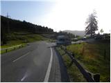
Durch den Karawankentunnel gelangen wir nach Österreich und fahren weiter auf der Tauernautobahn. Weiter durch den Katschbergtunnel und später den Tauern-/Tauerntunnel, der Autobahn Richtung Salzburg (auch Solnograd) folgen wir nur bis zur Ausfahrt Bischofshofen, von wo wir auf einer vierspurigen Straße zum bereits genannten Ort weiterfahren. Von Bischofshofen folgen wir den Schildern nach Höchkonig und Dienten am Höchkonig. Die Straße beginnt anzusteigen und bringt uns zum Dientner Sattel. Vom Sattel fahren wir noch gut 100 Meter auf der abschüssigen Straße weiter, dann bemerken wir rechts den Parkplatz, auf dem wir parken.
Beschreibung der Route:
Vom Parkplatz folgen wir den Markierungen »Erichhütte 30min« auf die für den Verkehr gesperrte Bergstraße. Die Schotterstraße, auf der wir aufsteigen, führt an Weiden mit schönem Blick auf die Hohen Tauern und die nahen Gipfel oberhalb der Erichhütte vorbei. Der Weg führt dann durch einen kurzen Waldstreifen, wo wir auch einen kleinen Bach queren. Weiter verläuft der Weg wieder an Weiden bis zur Erichhütte auf der Alm Schönbergalm.
Von der Hütte gehen wir rechts den Markierungen »Königsjodler Klettersteig, Hochkönig« folgend und steigen leicht auf grasigen Hängen nach Nordosten auf. Der Weg bringt uns bald zu einer Wegkreuzung, wo wir links Richtung Hochkönig weitergehen, rechts führt der Weg zum Gipfel Taghaube (2159 m).
Weiter steigt der Weg eine Weile bei spärlichem Latschen auf, dann bringt er uns über einen etwas steileren grasigen Hang zu einer weiteren Kreuzung. Rechts gesicherter Klettersteig auf Granlspitz (2307 m), wir gehen links zur Scharte Hochscharte.
Hier biegt der Weg leicht links ab und bringt uns von den grasigen Hängen auf steilere Felsen, die wir zunächst nach Norden queren. Nach dem Quergang biegt der Weg rechts ab und steigt zur Scharte Hochscharte auf. Auf diesem Abschnitt ist der Weg ziemlich bröckelig und eine kurze Leiter hilft uns. An der Scharte gehen wir links weiter und nach kurzem Anstieg sind wir wieder an einer Kreuzung.
Links ist nur noch ein kurzer Anstieg zum Einstieg in den extrem anspruchsvollen Königsjodler-Weg, wir gehen rechts weiter und steigen durch die Rinne auf die Ostseite des Grats ab. An der Kreuzung gibt es auch eine Warnung wegen Steinschlaggefahr auf dem Weg. Der Weg in der Rinne ist ziemlich bröckelig und mit Stahlseil gesichert. Tiefer biegt der Weg aus der Rinne links ab und es folgt ein ungesicherter Quergang, der uns zu einer Kreuzung bringt.
Wir gehen links auf Weg 432 den Markierungen Hochkönig folgend weiter, rechts führt der Weg zur Alm Stegmoosalm. Weiter steigt der Weg auf einem ziemlich steilen und etwas bröckeligen Hang an. Sicherungen am Weg sind sehr selten, daher ist besondere Vorsicht geboten. Der Weg steigt dann noch eine Weile auf einem relativ steilen Hang an, der auch rutschgefährlich ist. Vom Weg öffnet sich ein schöner Blick zum Hochkönig, die ganze Zeit haben wir auch Blick auf die »Teufelshörner«, über die der Königsjodler-Weg führt. Später wird der Weg noch etwas bröckliger, gelegentlich helfen Haken oder Seil. Höher wird der Hang etwas weniger steil, aber voller Schutt, daher immer noch Vorsicht. Bis zur Scharte Birgkarscharte folgt ein diagonaler Anstieg über rutschigen Schutt.
An der Scharte, wo sich schöne Ausblicke nach Norden öffnen, gehen wir links weiter, rechts führt der Weg zum Hochkönig, dem höchsten Gipfel der Berchtesgadener Alpen. Weiter führt ein weniger anspruchsvoller Weg am Nordhang des Panoramagrats entlang und bringt uns bald zum Gipfel.

Entlang der Route: Birgkarscharte (2847m), Hochscharte (2283m), Erichhütte (1545m)
Die Tour kann zu folgenden Zielen verlängert werden: (3 h)
Fotos:
 1
1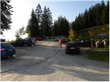 2
2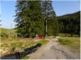 3
3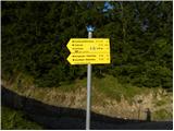 4
4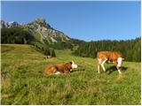 5
5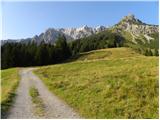 6
6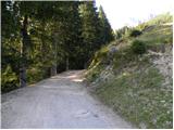 7
7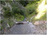 8
8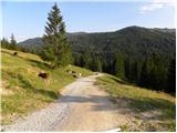 9
9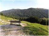 10
10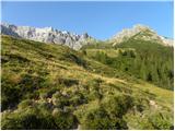 11
11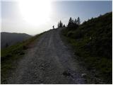 12
12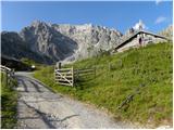 13
13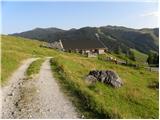 14
14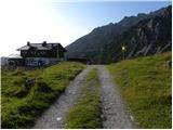 15
15 16
16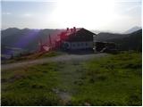 17
17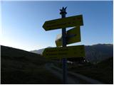 18
18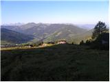 19
19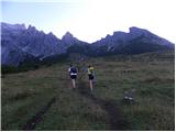 20
20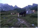 21
21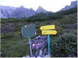 22
22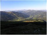 23
23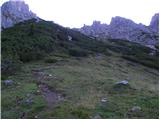 24
24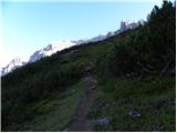 25
25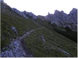 26
26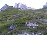 27
27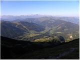 28
28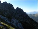 29
29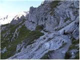 30
30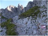 31
31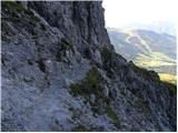 32
32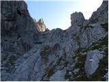 33
33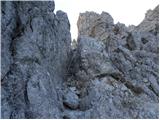 34
34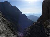 35
35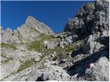 36
36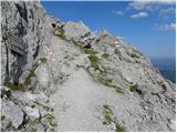 37
37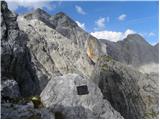 38
38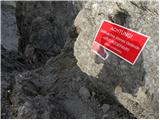 39
39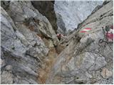 40
40 41
41 42
42 43
43 44
44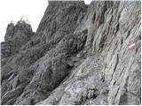 45
45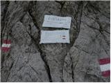 46
46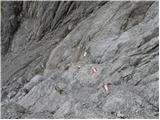 47
47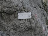 48
48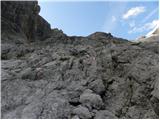 49
49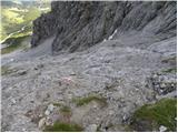 50
50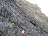 51
51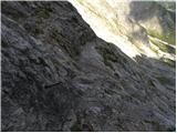 52
52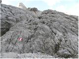 53
53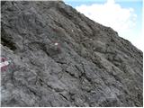 54
54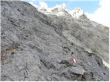 55
55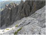 56
56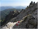 57
57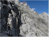 58
58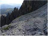 59
59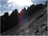 60
60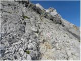 61
61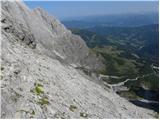 62
62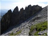 63
63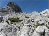 64
64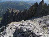 65
65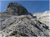 66
66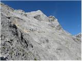 67
67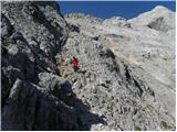 68
68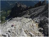 69
69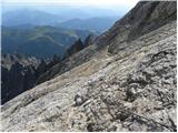 70
70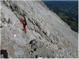 71
71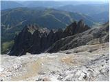 72
72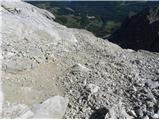 73
73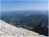 74
74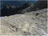 75
75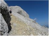 76
76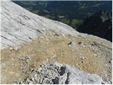 77
77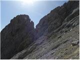 78
78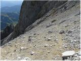 79
79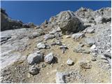 80
80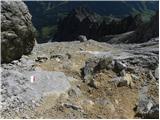 81
81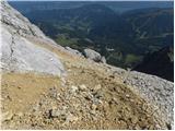 82
82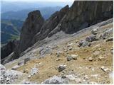 83
83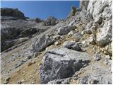 84
84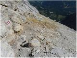 85
85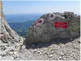 86
86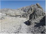 87
87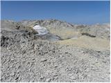 88
88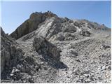 89
89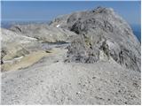 90
90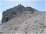 91
91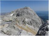 92
92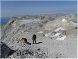 93
93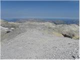 94
94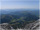 95
95 96
96
Diskussion zur Tour Parkirišče Erichhütte - Hoher Kopf (Weg 432)
Um einen Kommentar zu schreiben, müssen Sie sich anmelden:
Falls Sie noch keinen Benutzernamen haben, müssen Sie sich zuerst
registrieren.