Wettervorhersage - Schartenkopf
Wettervorhersage Schartenkopf:
Aktualisiert: 23. 07. 2026 12:33
|
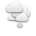
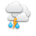
| | 2h |
| |  |
| Temperatur: | 0 °C |
| Niederschlag (mm/h): | 0 |
| Bewölkung: | 100% |
|
| 5h |
 |
| 0 °C |
| 0,03 |
| 96% |
|
| 8h |
 |
| 3 °C |
| 0 |
| 80% |
|
| 11h |
|
| 3 °C |
| 0 |
| 80% |
|
| 14h |
 |
| 5 °C |
| 1,5 |
| 40% |
|
| 17h |
|
| 5 °C |
| 1,5 |
| 40% |
|
| 20h |
 |
| 0 °C |
| 0 |
| 73% |
|
| 23h |
 |
| 0 °C |
| 0 |
| 89% |
|
|
| | 2h |
| | |
| Temperatur: | -1 °C |
| Niederschlag (mm/h): | 0 |
| Bewölkung: | 56% |
|
| 5h |
|
| -1 °C |
| 0 |
| 69% |
|
| 8h |
 |
| 1 °C |
| 0 |
| 20% |
|
| 11h |
 |
| 4 °C |
| 0 |
| 20% |
|
| 14h |
 |
| 6 °C |
| 0 |
| 0% |
|
| 17h |
|
| 7 °C |
| 0 |
| 0% |
|
| 20h |
 |
| 1 °C |
| 0 |
| 0% |
|
| 23h |
 |
| 1 °C |
| 0 |
| 91% |
|
|
| | 2h |
| | |
| Temperatur: | 1 °C |
| Niederschlag (mm/h): | 0 |
| Bewölkung: | 76% |
|
| 5h |
 |
| 3 °C |
| 0 |
| 67% |
|
| 8h |
|
| 10 °C |
| 0 |
| 80% |
|
| 11h |
|
| 11 °C |
| 0 |
| 79% |
|
| 14h |
|
| 12 °C |
| 0 |
| 0% |
|
| 17h |
|
| 13 °C |
| 0 |
| 20% |
|
| 20h |
 |
| 8 °C |
| 0,03 |
| 96% |
|
| 23h |
|
| 6 °C |
| 0,03 |
| 99% |
|
|
| | 2h |
| | |
| Temperatur: | 4 °C |
| Niederschlag (mm/h): | 0,11 |
| Bewölkung: | 99% |
|
| 5h |
|
| 3 °C |
| 0,53 |
| 99% |
|
| 8h |
 |
| 4 °C |
| 1,6 |
| 100% |
|
| 11h |
 |
| 4 °C |
| 2,76 |
| 100% |
|
| 14h |
|
| 3 °C |
| 2,76 |
| 100% |
|
| 17h |
|
| 3 °C |
| 0,25 |
| 99% |
|
| 20h |
|
| 3 °C |
| 0,18 |
| 98% |
|
| 23h |
 |
| 2 °C |
| 0,23 |
| 96% |
|
|
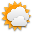
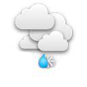
| | 2h |
| |  |
| Temperatur: | 2 °C |
| Niederschlag (mm/h): | 0,38 |
| Bewölkung: | 94% |
|
| 5h |
 |
| 2 °C |
| 1,08 |
| 97% |
|
| 8h |
|
| 3 °C |
| 1,61 |
| 99% |
|
| 11h |
|
| 4 °C |
| 1,61 |
| 96% |
|
| 14h |
 |
| 6 °C |
| 0,91 |
| 93% |
|
| 17h |
|
| 5 °C |
| 0,91 |
| 85% |
|
| 20h |
 |
| 4 °C |
| 0,03 |
| 74% |
|
| 23h |
|
| 3 °C |
| 0,03 |
| 66% |
|
Wettervorhersage für den Standort Schartenkopf. Schartenkopf ist ein Berg im Gebirge Nördliche Kalkalpen (
Österreich) auf einer Höhe von 2308 Metern über dem Meeresspiegel.
Webcams in der Umgebung
km:
Aberg (Abergalm),
Aberg - Maria Alm,
Dienten - Hochkönig,
Funtenseetauern,
Hintersee,
Hochkönig,
Jenner - Hohes Brett,
Jenner am Königssee,
Kärlinger Haus - Funtensee,
Kehlbach (Sommerrodelbahn),
Leogang,
Maishofen,
Maishofen Sausteige,
Maria Alm,
Maria Alm (Aberg),
Maria Alm (Natrun Bergstation),
Mitterkaserlift,
Saalfelden,
Schönau am Königssee - Jenner Bergstation
Berge in der Umgebung
km:
Panoramen in der Umgebung
km:
Wettervorhersage auf Ihrer Website